What is this?
This is documentation of a personal century ride for the UMCA Year-Rounder Challenge. The basic idea is to make at least one 100-mile ride in each month of 2007. It gets me out when it might otherwise be too easy to say “too bad the weather wasn't better this month.”
October 27, 2007
Route Overview
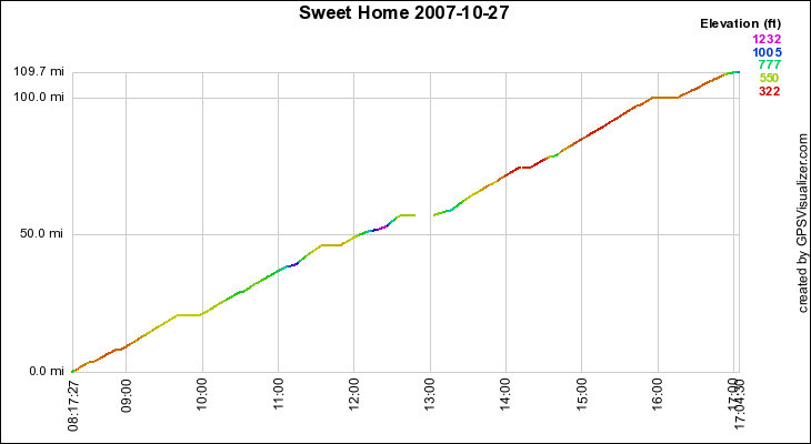
- Start: 8:17, Southwest Eugene, OR
- Stop: 5:04pm, Southwest Eugene, OR
- Miles: 109
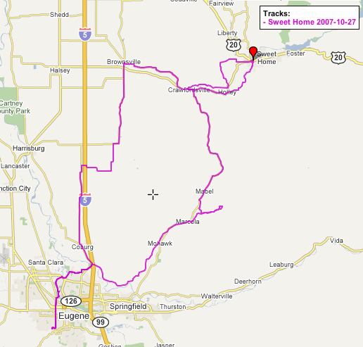
A refinement to the Sweet Home leg of my loop through Marcola, Crawfordsville, Sweet Home, Crawfordsville, Brownsville. Less of Highway 228, replaced by some back roads (Crawfordsville Drive and Fern Ridge going out to Sweet Home, Old Holley Road coming back). Fern Ridge adds a pretty good climb, too.
Original version of the profile said 112 miles, and the GPS computer said 116, but I now understand why this is: When I lose the satellite signal, it sometimes gets some wild points just before losing the signal and just after regaining it. I can lose miles if part of the path is not plotted, and I can gain fantasy miles from the wild points. In this case I was able to edit out the bogo-points by hand, isolating them by creating waypoints. Editing to clean up dirty GPS data ought to be a feature of some of the many GPX software packages, but I haven't found one. The way I did it is not practical for non-geeks. (KML version is original and unedited, including the portion in which GPS says I was riding 255 miles per hour.)
Gorgeous weather, near freezing at first but rising to 60 or so, sunny and fairly calm (slight north wind).
Route map
As gpx (open in some route viewing applications, including GPS Visualizer) or as kml (open in Google Earth).
Time/Distance Plot