What is this?
This is documentation of a personal century ride for the UMCA Year-Rounder Challenge. The basic idea is to make at least one 100-mile ride in each month of 2007. It gets me out when it might otherwise be too easy to say “too bad the weather wasn't better this month.”
April 15, 2007
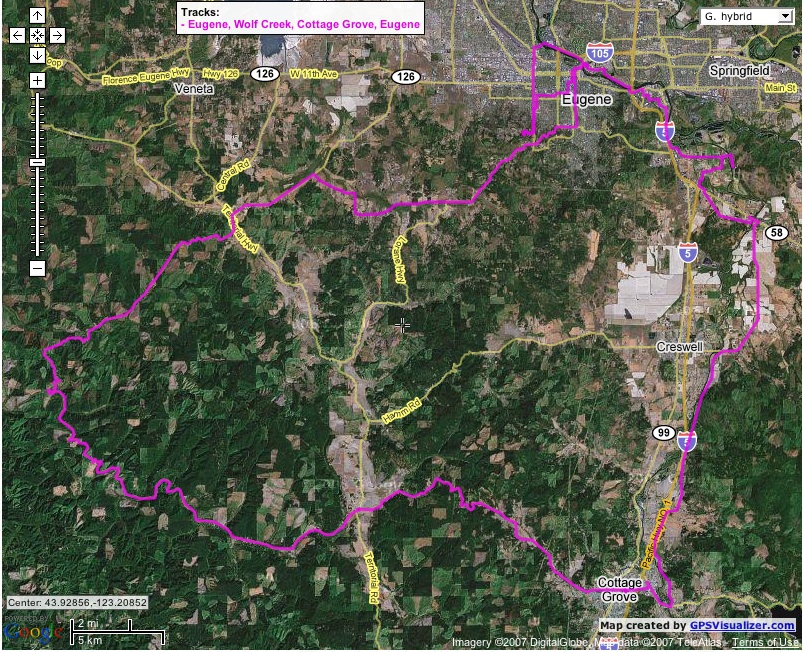
Route Overview
- Start: 9:13am, Southwest Eugene, OR
- Stop: 5:52pm, Southwest Eugene, OR
- Miles: 101.6
- Route:
From start in SW Eugene to Alton Baker Park, Eugene (for start of Sunday group rides). Out of town SW on Lorane Highway, then Spencer Creek and Erickson to Crow Road, almost to Crow but turn South on Territorial Road to pick up Wolf Creek Road. Climb Wolf Creek S/SW to Siuslaw Highway, Siuslaw Highway E to town of Lorane. Parted ways with my riding partner at Lorane to continue over Cottage Grove-Lorane Road E to Cottage Grove, then N on Sears Road to Cloverdale Road, N on Cloverdale to Highway 58, briefly E on Highway 58, continuing on Mathews Road, crossing 58 again and continuing S and E on Seavey Loop to Franklin Blvd with a brief stop at the Mount Pisgah Arboretum. Franklin to Nugget, cutting across to Franklin again and then North Bank Bicycle Path all the way back to Chambers. Climb Chambers and McLean to return home.
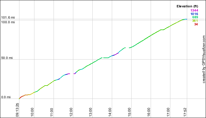
Time/Distance Plot
Route maps
As kml (open in Google Earth).
As gpx (open in some route viewing applications, including GPS Visualizer).